
Our Services
for your project
Q-con GmbH offers a
full end-to-end service for the monitoring of
induced and natural seismicity:
Project Scoping >> Planning >> Hardware >> Software >> Installation >> Operation >> Monitoring >> Analysis
In addition, we support you with comprehensive scientific consulting services in the areas of seismic risk assessment, numerical reservoir simulation and the analysis of reservoir and production data.
Our Commitment
From planning to operations,
we offer rigorous scientific consulting and reliable, technically proven systems,
supporting you in utilizing your resource safely, efficiently, and economically.
01
Seismic
Monitoring Systems

Network Design
At Q-con, you receive seismic monitoring systems that are specifically configured for your individual requirements and the geological conditions at your site. As part of the network design process, we clarify all the key data and parameters.
-
Planning of the optimal network geometry – taking into account noise sources, infrastructure and regulatory requirements
-
Modeling of detection capability and localization accuracy taking into account the geology and other local conditions
-
Determination of the exact station locations by measuring the background noise level and in accordance with available locations
-
Selection of suitable seismometers, data loggers and other system components
-
Integration of existing stations, if required


02
Seismic Monitoring Service


Permanent Seismic Monitoring
Our systems are designed for low-maintenance, fail-safe continuous operation and enable uninterrupted monitoring of all seismic activity in the area of the reservoir or deposit.
During continuous monitoring, a traffic light control system can be activated, which automatically and without delay sends messages and alarms via SMS/email to the recipients you have defined, in accordance with official regulations or your own specifications.
Our proprietary detection algorithms – optimized over decades – define the state-of-the-art in terms of detection accuracy and response time. They provide you with the highest possible protection against unnecessary operational downtime, service interventions, and costs caused by false alarms or overlooked safety-critical events.
Upon request, we can provide you with a dedicated secure website, which allows you to check the seismic activity (detected events, magnitudes, peak ground velocity, etc.) and system status (system health, battery level, etc.) at any time.
Furthermore, our team of experts ensures continuous quality control and offers regular reporting tailored to your needs.


03
Seismic Hazard Analyses
and Risk Assessment

Seismic Hazard Analyses
The exploration and subsequent extraction of an underground resource alters the natural conditions in the subsurface (stress conditions, fluid pressure, temperature, etc.). Under certain circumstances, this can lead to fracturing and thus to induced seismicity. The probability of occurrence and the intensity (magnitude) of such seismic events depend on a wide range of factors.
Based on local geological conditions (faults, stratigraphic boundaries, stress fields, etc.), we analyze the seismic risks associated with your project. We also advise you on how these risks can be reduced by adapting development and operational concepts.


04
Reservoir Simulation


Simulation of induced seismicity
Seismic processes are simulated and investigated using analytical methods and our 3D finite element models. In this context, we address questions such as:
-
How does the sress field change as a result of resource development measures or during operation?
-
Which faults within the influence area of the reservoir/deposit are susceptible to seismic activation?
-
What are the expected maximum magnitudes ?
-
How can development and operational concepts be optimized with regard to seismic risk?
05
Data Analysis


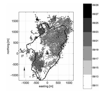


Seismic data analysis
The seismic data sets obtained from the monitoring can be used for detailed evaluation and interpretation in the context of the reservoir and operating parameters.
-
Creation of interactive 3D visualizations of the spatio-temporal evolution of seismicity
-
Identification of geological faults
-
Determination of reservoir geometry
-
Investigation of fracture mechanisms, the local stress field, and its temporal variations
-
Investigation of spatio-temporal changes in pressure and local stress regime